A Walk in the Cotswolds
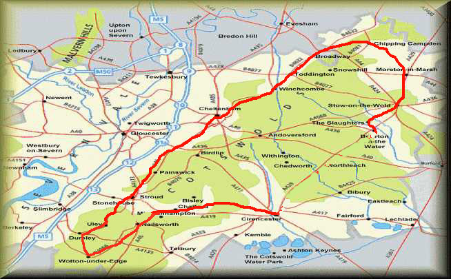
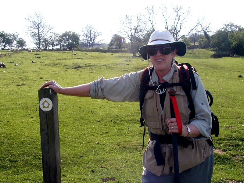
This diary documents a walk Kelia and I made in the Cotswold region of western England in April of 2002, starting in Cirencester and ending in Bourton-on-the-Water (here's a map). We walked about 90 miles over 10 days through some really beautiful countryside, and experienced the warm hospitality of the English people. For convenience, we scheduled our walk from B&B to B&B - it's a bit more expensive that way, maybe, but a lot simpler to arrange than campings, and a lot easier on our bodies, since we didn't have to carry sleeping bags, pads, tents, stoves, etc. As it was, we were each carrying about 30 pounds, including water, and that was plenty!
We had originally planned to do this walk one year earlier, and had actually planned all of it out, but the outbreak of the hoof-and-mouth disease in England two weeks before we were to go shut down almost all of the countryside, which wreaked massive damage not only to the farmers, but also to everyone there who depends on the tourist trade. I was quite pleasantly surprised this year to find almost all of the people I had scheduled last year were still in business and eager to host us.
Note - most of the pictures are about 250kb, and will take a bit of time to download if you have a dialup connection. With DSL or cable, you should have no problems.
13/14-Apr - Houston to Cirencester
The flight over was typical of the last several - packed jam full. This one was a bit worse for us with regards to rest - for some reason, neither of us was able to sleep much. Dawn and breakfast at dawn came much earlier than we would have wanted.
At least the plane was on time, and we were able to reclaim our baggage and clear customs in short order. Our plan was to worship in Tunbridge Wells, only about 30 miles from Gatwick, but our prior experiences with the trains on Sunday, when they do the track maintenance, did not bode well for success. Thankfully, Stephen Daniell had offered to pick us up, and was right there. We got to the Daniells' home about 8:15 to discover several house guests - Duncan from South Africa, Hazel home from university, and Derek's sister from Bristol. We had about 90 minutes to visit before walking down to the meeting house for Bible class and worship. I was expecting Derek to preach, but in fact his son Paul did. Kelia and I were both quite tired, and had a tough time staying awake.
After the assembly, the whole church came back to the Daniells' house for lunch. We had a delightful visit - there were people all over the house, and multiple simultaneous conversations, and we were a bit frustrated at having to leave at 14:45 to catch the train west from Tonbridge.
The trains turned out to be no problem, but we did find them a bit pricey - the one-way tickets from Tonbridge to Kemble were GBP 35 each. The ride itself was uneventful, including a tube trip from London Bridge station to Paddington, which proved again the value of packing light.
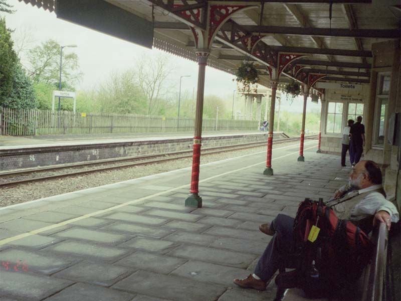
We were taken a bit aback when we got off the train in Kemble - it was basically a station out by itself in the country, totally devoid of people and all locked up (here's a picture of it made at the end of our trip). Then, while we were trying to figure out what to do, it started sprinkling. We had thought that we might walk to Cirencester from the station (4 miles), but our fatigue and the rain decided against that. Fortunately, just then a taxi pulled up to deliver passengers to the station, so we just engaged him for the ride back to town.
We had dinner at the 'Waggon & Horses', including a very tasty dish we had never seen before - a pie made with chestnuts, vegetables, cheddar cheese, and cranberries, with a sweet cranberry cream sauce. Quite tasty! The publican was a photographer and camera collector. He had some of his photos and a bunch of his cameras on display, and we had a good visit with him about photography and the state of the art.
It was still before 9pm when we got back to our room, but we were tired enough that we went to bed straightaway.
15-Apr - in Cirencester
We slept pretty much straight through to 8am, waking with the alarm. After one of those English 'cooked breakfasts', we set out to explore Cirencester. Our plan to have an off day before starting our serious walking was clearly a wise choice - neither of us felt up to tearing up the spaceways just yet.
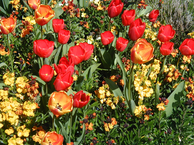
We spent the day just walking around, taking in the sights - the open-air market, the shops, the very impressive church building, the parks, the gorgeous flowers, buying lunch at a bakery and eating it sitting on a little stone fence, then went to the Roman museum, which gave a good sense of what life in Corinium was like. After that, we walked over to the old amphitheater, then back through St. Michael's Park to our room for a nap, which we both sorely needed.
After the nap, we popped down to the Indian food takeaway and got a 'feast for two' set meal which we brought back and ate in the dining room at the B&B. It was good! We had thought about taking in a movie, but by the time dinner was over, we weren't up to anything more than watching an hour or so of British (i.e., bad) television before going to sleep.
Day 1 - 16-Apr - Cirencester to Minchinhampton (15 km)
Here's the map of the whole walk. Cirencester is about 50km due west of Oxford.
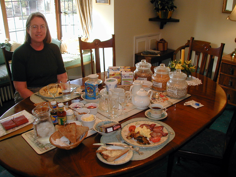
OK, time to start walking. If you're going to walk like this, England is the place to do it. These 'cooked breakfasts' of cereal, toast, eggs, ham, sausage, tomatoes, beans, mushrooms, and coffee or tea have enough calories to power you all day long!
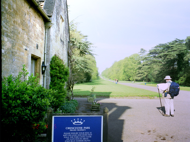
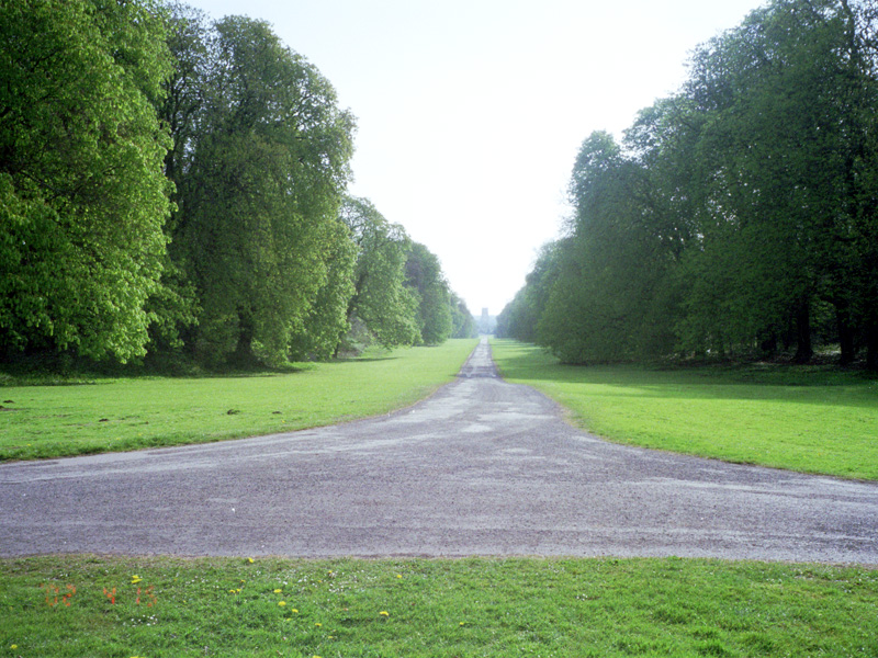
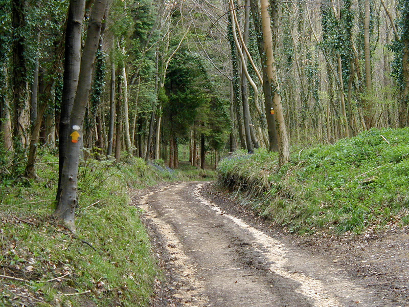
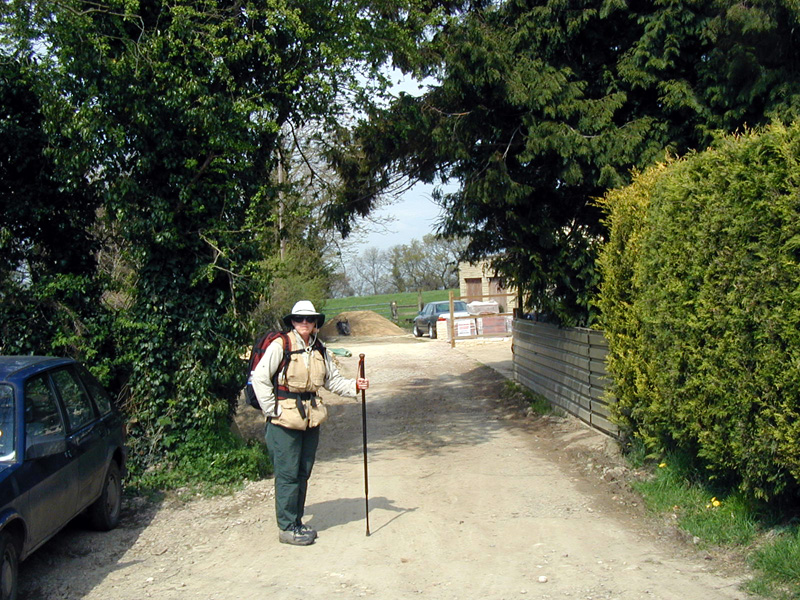
We got everything packed up and were out the door just at 9am. We walked back through the town to the entrance to Cirencester Park, the private holding of Earl Bathurst, but which has been opened to access by walkers and riders. The park is basically a straight lane of grass about 5 miles long, surrounded on both sides by a strip of forest. The neatest part, other than the green, was the fact that the lane (or 'ride') was perfectly lined up with the bell tower of the church building, and for several (well, 2, anyway) miles, we were able to look back and see the (very slowly) shrinking image of the tower.
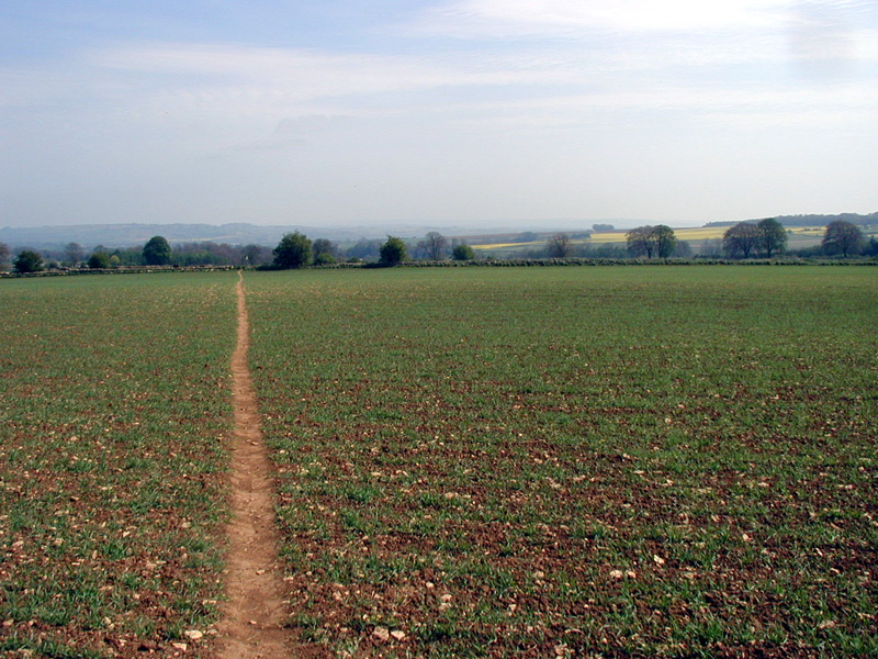
Once we got out of the wood, we were on a paved bridleway for a while - very easy walking. Eventually we were onto the edge of some fields planted in grass but looking like they were planted in stones and enjoying a bumper crop. We found out later that the soil is only a few inches thick, and that it isn't worth the effort to take the rocks out for what you could grow there. Those rocks must really do a number on plows!
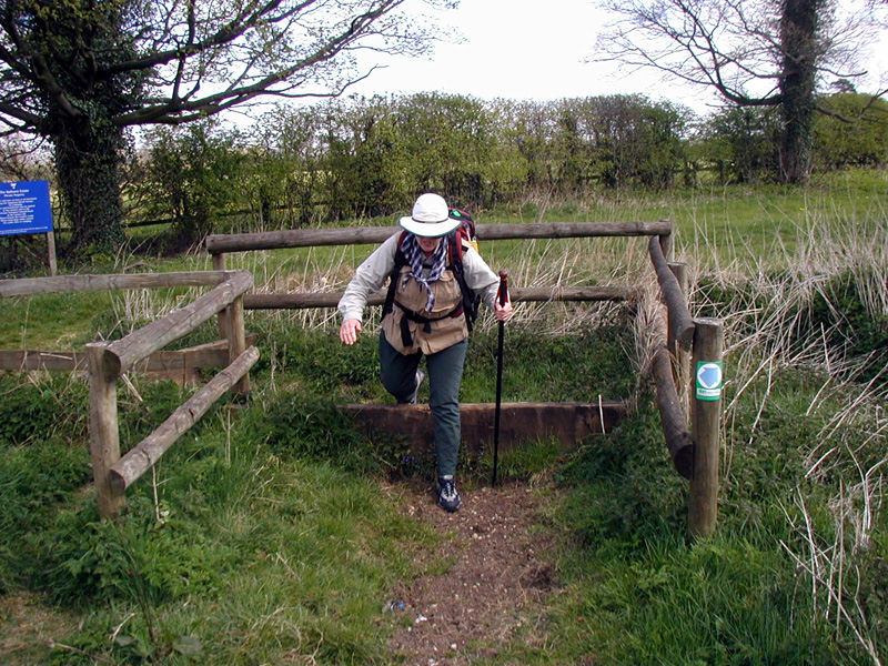
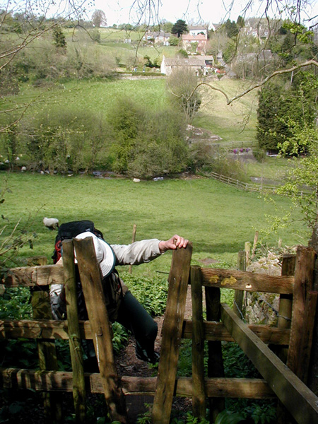
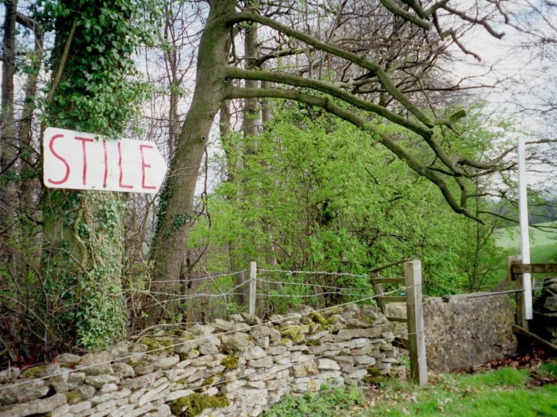
Later on, we started in earnest to cross fence lines with stiles of various sorts, the common way to do so. The only difficult part of the whole day's walk was the last 200 yards, which we had to go on the edge of a very busy road with no shoulders, so we just walked fast.
The proprietors at this B&B were willing (and apparently eager) to sit and talk, so we did just that - for almost 3 hours. By that time, we had gotten past small talk and onto religious and political philosophies, fairly vigorous (but not acrimonious) discussion. We broke off around 6 to take showers and pop across the street for supper at a pub, a meal less impressive than other 'pub grub' we have had, but certainly adequate. Afterwards, we just watched English (i.e., bad) television for a short while before dropping off.
Day 2 - 17-Apr - Minchinhampton to Wotton-under-Edge (16 km)
We got up in time for a reasonably early full cooked breakfast, but ended up sitting around talking with our B&B hosts until 10am. Because we had gotten in so early yesterday, and because we were looking at a walk only 1 or 2 km longer than yesterday's, we weren't in any big rush to get underway, and we were enjoying the conversation. The way today led through open land more than woods, although there was some of that as well. The forecast was for rain, but we were seeing partly cloudy and dry, and reasonably cool - nice walking weather! We walked into Minchinhampton and on around the green Common - 500 acres of grass. Turning south, I immediately became confused when I couldn't reconcile the map to the territory I was seeing - something that was to happen several times more today. Fortunately, we were able to keep bearing south (as desired) until we could reconnect. That's a reality of walking in western Europe - you can't actually be very lost, only confused as to exactly where you are for a bit.
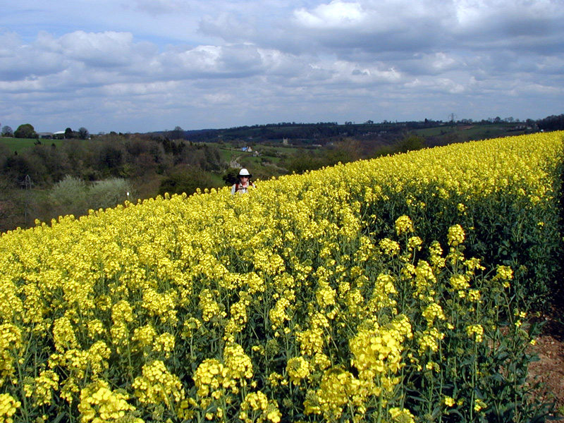
After walking along an empty road and dropping down a muddy path, we stopped in at a bakery in Nailsworth for lunch, which we ate at the town clock. On leaving the town, I got disoriented again, and we spent yet more staring at the map. By the time we worked it out, it was well after noon, and we were only about 1/3 of the way along. Unfortunately, it did not improve as the afternoon went on. It wasn't until we were walking through a large field of rapeseed (yes, we were on a legitimate trail - it ran right through the middle of the field), after once more trying to find us on the map, that it came to me what the problem was: I was consistently overshooting the waymarks and consistently underestimating the distances. The remedy for all the confusions I had had today was to go on a bit farther, and once I figured that out, the navigating problems disappeared.
We were doing okay, if late, until we passed the village of Kingscote. On its south side were two down-and-back-ups that tired me greatly and almost shut Kelia down. They are pretty, but very steep - although we were walking on roads designed for little cars, we saw very few, and I'll bet they were all in bottom gear!
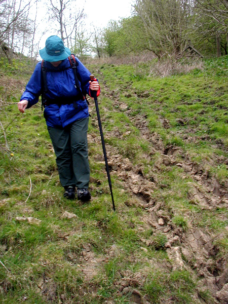
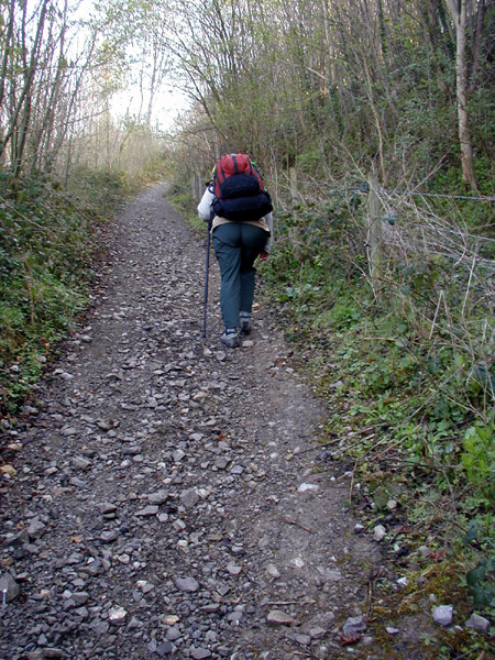
After we had suffered through that (Kelia's word, not mine), we thought the last few miles along a stream would be easier because level. That turned out not to be the case. The part along the stream was called the Tyley Bottom, and was a long strip of uneven grassland punctuated with rain-runoff gullies. To make the footing completely treacherous, the whole bottom was potholed with horse tracks that had been made when the ground was wet, then hardened like concrete into the hiker's equivalent of caltrops. I must say it was a most taxing hour or two getting through to the streets by the town, and by the time we got to our room, Kelia was aching everywhere.
The room in Wotton-under-Edge was no great shakes, but our hostess was very kind and gracious, even though really we were tired beyond caring. We took showers. I washed our clothes. We crashed.
Day 3 - 18-Apr - Wotton-under-Edge to Uley (8 km)
Nourished with a full cooked breakfast virtually identical with the prior ones, we sallied forth at 9:15, Kelia still pretty achey. We got through the town center in just a few minutes, then were immediately faced with the climb up Wotten Hill. It was steep, but the view from the top was wonderful. The hill top was wooded, so we enjoyed a very satisfying walk, stopping to chat with a walker who kindly took our picture for us.
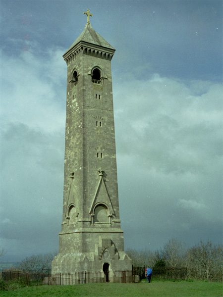
The trail comes out on the western end of the hill near North Nibley and the Tyndale Monument, erected in Victorian times to North Nibley's most illustrious citizen, William Tyndale. The monument is taller than it appears from a distance, which is good - we've been bitten by the Chamber of Commerce photo of the giant jackrabbit in Fort Stockton! Just when we were at the base of it (the monument, not the jackrabbit), trying to take a little shelter from the stiff breeze on the hill edge, a caretaker/maintenance man walked up and asked if we wanted to go up to the top. Silly question! He unlocked the door and we climbed a stone circular staircase of 121 steps, mostly in the dark. From the top the views were superb, of course, although we had a bit of a problem because of the fierce winds whipping through the small windows. Making our way back down without incident, we took a trail that rapidly dropped to a stream crossing, then led steeply up the appropriately-named Breakheart Hill - a sharp climb up a trafficked road and narrow shoulders - no fun for either of us!
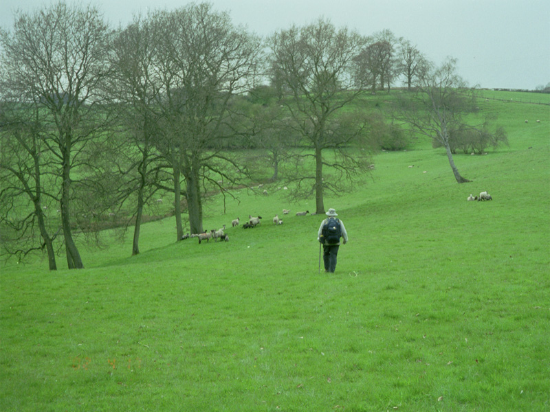
At the top we got back into woods and onto a trail that led right through the middle of a sheep fold - the first, but by no means the only time we did this - before once again causing us to shed altitude at a prodigious rate, and emptying straight onto the streets of Dursley. It was after 2pm by this time, so we stopped for lunch at a Doner Kabob house that served portions so large we couldn't finish them, a practice that helped us set a policy for our meals later.
With a fair number of creaks and groans, we set off again, picking up the official Cotswold Way right at the edge of town, and almost immediately getting off it again, since it led UP the side of Cam Long Down (200 m climb), went 500 m along the top of the Down, then DOWN 200 m on the other side. There was another trail that led alongside a stream (read: level!) along the side of the Down. It was about this time that Kelia decided that "all Cotswold roads go uphill." It's an old observation, though, Shakespeare has the Duke of Northumberland say (in Richard II, act II, iii, 3):
"I am a stranger here in Gloucestershire.
These high wild hills and uneven ways
Draw out our miles
and make them wearisome."
Anyway, we found the flat way good enough for us, and rolled in to Hodgecombe Farm about 4:30. Most of our hosts in England (in contrast to continental Europe) make tea for you when you walk in the door and sit and talk with you while you drink it. We had a delightful visit for probably 2 hours before retiring to our room.
For both of the last two nights, we had found that having eaten a full cooked breakfast and lunch somewhere along the way, we just weren't that hungry in the evening, so we decided to manage with only those two meals each day for most days. Often we didn't find much to do in the the places where we stayed, but Kelia was generally too tired to want to do anything, anyway. In addition, the humdrum of British television was being interrupted by one of the high points of the broadcast year, the televising of the national snooker championships!
Day 4 - 19-Apr - Uley to Edge near Painswick (14 km)
Nourished with a full cooked breakfast virtually identical with the prior ones, we walked away from the farm and IMMEDIATELY up a long slope up the side of a hill, steep, like all the slopes we have been on so far. It seems that almost all of the slopes have been straight up or down the slopes - no switchbacks to waste time on!
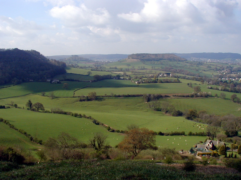
Once at the ridge, we followed it north several km along a wooded track punctuated with wonderful views off over the Severn valley. The weather has continued to be clement, even counting the half-hour of very light rain and soft sleet that we encountered yesterday just before the farm.
We had a spot of trouble finding the path off the ridge and down by King's Stanley, but we called down to two men in a yard below, who had us come down through the field, climb through their fence, and get onto the road via their driveway.
From Middleyard to Selsley we were climbing again, but on the sidewalk of a road, so on a gentler slope than the footpaths - but still with beautiful views. We dragged in to Stroud about 2pm and decided to eat lunch in the cafe of a supermarket there, taking an entire hour to rest.
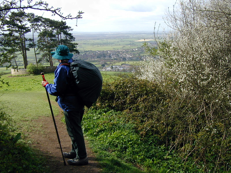
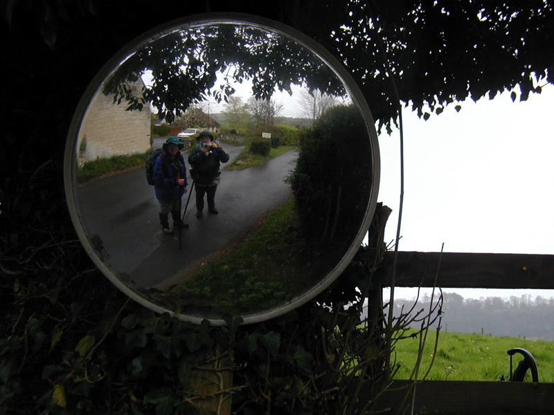
Between Selsley and Stroud we had given up altitude (we ate just a block from the river crossing), so our first order of business after lunch was, of course, to gain it all back. We climbed through town to Whiteshill and Pitchcombe, crossing through more sheep fields, and thought we were almost there. At Jenkin's Farm, there was a sign posted indicating that our footpath had been closed for a month for bridge repair but suggesting by the dates that it might be open by now, so we proceeded. Our mistake. We spent about an hour wandering around the fields trying to find an alternate route before finally ending up back on the road where we started. In the event, the walk on the road wasn't as nasty as I had feared, and we found the B&B at Upper Doreys Mill without difficulty. (Most of the roads over here - at least, outside of built-up areas - have no shoulder, and with the volume of traffic, it is patently dangerous to walk on them. Often, there are footpaths provided that run parallel to the roads in the woods - but not always! Some of the roads are dangerous enough to have their own mirrors to see around corners.) We were pretty whipped when we got to the B&B, but we were pretty hungry, too, in spite of having had lunch. Sylvia was very kind to us, and drove us up to the pub in Painswick - 3/4 mile solid uphill! Whew! It being Friday night, we got the last open table and had a substantial meal which gave us enough energy to walk the 3/4 mile (straight DOWNhill!) back to the farm and crawl into our beds.
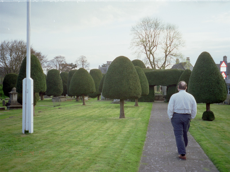
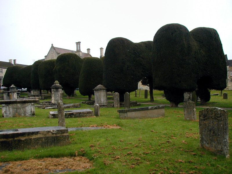
Day 5 - 20-Apr - Edge to Cheltenham (17 km)
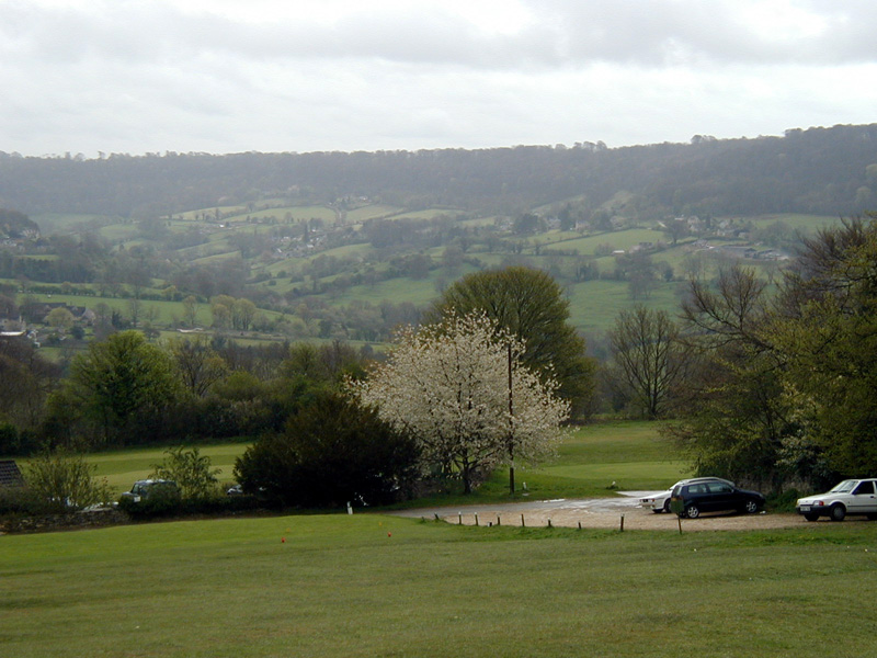
We were up a bit later getting off this morning due to our tiredness and Sylvia's timetable, but nourished with a full cooked breakfast virtually identical with the prior ones, we set off before 10am for our longest day's walk, all the way to Cheltenham. We started by going right back into Painswick and through the churchyard with its 100 shaped yew trees, then onto Painswick Beacon, with a totally perverse golf course (views from the fairway down to the tee box and up to the green (we assume)), but with a great view of Gloucester. The rest of the morning's walk was pleasant, if on occasion strenuous, for several miles through wooded land, including a nature reserve, through which we walked on a road rather than the Cotswold Way, which went up and down around. Sometimes during this walk we would cross into a field and have a difficult time finding the stile on the opposite fence, and would walk all over the field looking for the way out. Today, we found one landowner's solution to the problem, which must have been a vexing problem for him! It was well into the afternoon by the time we exited the woods at Birdlip, so we plopped ourselves down for a power bar lunch under a cell tower.
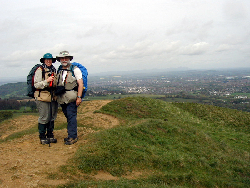
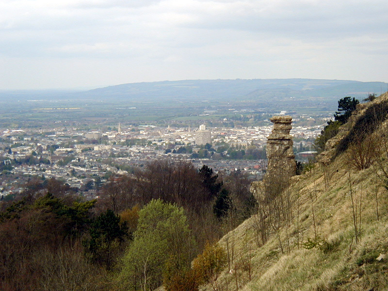
For the rest of the afternoon we saw lots of people, walkers and cyclists alike, even though we were still several miles out of town. We walked by some college with really attractive grounds, then hit another of those really torn-up bridle paths, thin one running steeply up Leckhampton Hill. Once we got to the top, we found no way across, and had to circle partway around (and down and back up2 of course) to get to where we wanted to be - on the front, with great views over Cheltenham and right on top of the Devil's Chimney, a single hoodoo sticking up on the edge of the escarpment.
The way off the hill was a precipitous drop straight down the side, ending at the fringes of Leckhampton. This was a case of looks being deceiving, since we still had about another 3 miles to go. We just schlepped ourselves along. I was pretty tired, and Kelia was miserable, but we kept going, and made it to our room about 5:30 - pretty good, considering. As tired as we were, we were more hungry, so we bathed, dressed for dinner, and walked a few (very few!) blocks to the Balti Walla, where we had a serious Indian dinner before limping back to our room and crashing.
(These days are wearying not so much because of their lengths - today's 11+ miles is still not that long - but because there are so many ups and downs of 100m or more. By the middle of the afternoon, when we encounter an up slope, it's down to step -- step -- step -- step - steady, but really slow.)
Day 6 - 21-Apr - Cheltenham to Greet near Winchcombe (13 km)
Not having any way to meet with the church in Bristol, we broke bread in our room before leaving it. Then, nourished with a full cooked breakfast virtually identical with the prior ones, we walked through the pedestrian zone in the Cheltenham town center and out through the suburbs. When we got to the Queen's Wood, I got confused on the map again, even though the trails are well-marked, but we immediately met some people who set us straight - straight up the side of Cleeve Hill, that is! The views from the tops of these hills are splendid without exception, but, man! the effort they require to get there!
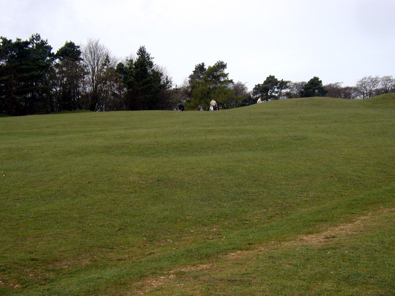
When we got to the top, we saw what we saw once before, on Painswick Hill, a golf course strewn all over the hill and down its sides, virtually none of it on level ground, and certainly not the fairways: from the tee, if you don't whack the ball hard enough to get up to a level place WAY up there, it will roll back BEHIND the tee. We passed one green that had berms on all four sides - I have no clue how a newcomer to the course would know where it was.
The map had a bunch of lines coming off the north side of the hill, but we couldn't find any waymarks, so we just scrambled down some rabbit trails - proving once again that the shortest, fastest way down may not be the most fun. The rest of the walk, though, was quite pleasant, if a little strange in part - we walked through a couple of residences, and quite literally through the middle of a fiberglass plant, past open storerooms, past chemical storage drums, past an effluent pond. It being Sunday evening, there was no one there - no one. Weird!
Right after that we were in the village of Winchcombe, where we stopped at a teahouse for lunch and a glass of elderberry pressé before walking just one more mile to Greet, to stay in Manor Farm, a really neat old still-operating farmhouse built in the 17th century. The farmer's wife who ran the place was also on the borough council - what we would call county commissioners' court - so we had an interesting discussion with her about farming and local rural politics. She was also kind enough to wash our clothes for us, which we very much appreciated.
Day 7 - 22-Apr - Greet to Broadway (15 km)
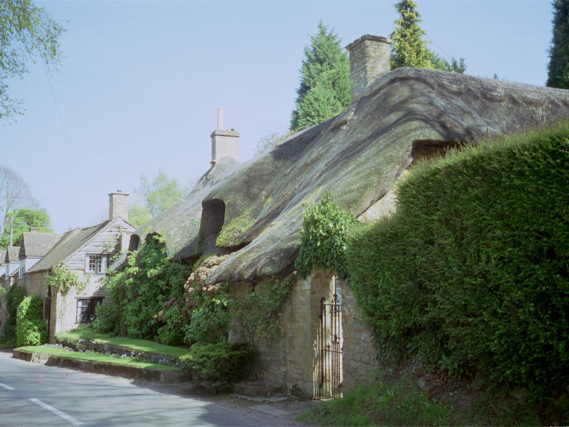
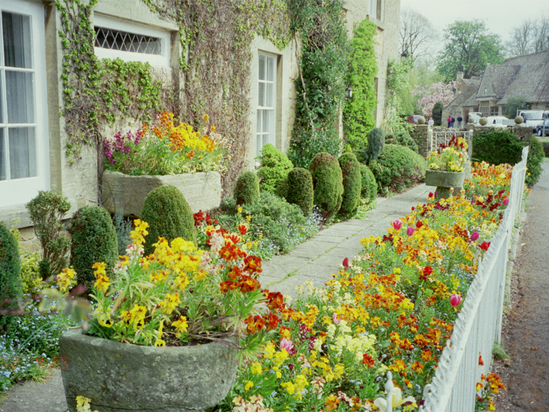
After a long discussion with Janet, and nourished with a full cooked breakfast virtually identical with the prior ones, we set out just after 9am. Although the way was long, it turned out to be much flatter overall, and we ended up making better time and enjoying it more than we had expected. After passing under a railway through a passage just big enough for pedestrians (novel to me that they would make the accommodation, rather than just have you walk across the tracks), our way led through a succession of villages, each a gem on a string of gems - Didbrook, Stanway, Stanton, Laverton, Buckland - all with houses of Cotswold stone, and all with flowers blooming on profusion - everything I had expected to see.
On the way, we stopped at our friend LaGard's house, knowing they wouldn't be there, and visited with their renter, an English professor from Lipscomb University who was there to write a book, for an hour or so before walking on into Broadway. Our hosts there were easily the most gemütlich of the whole walk, and we very much enjoyed the talk with them, both when we arrived and the next morning. He had done defense-related civil service (defence, he would say) all over the world, and had some great stories, as well as rifles given to him by Idi Amin and (not to be outdone) Mohamar Quadafi(!) That evening, we ate out and strolled up and down the high street before retiring.
Day 8 - 23-Apr - Broadway to Blockley (12 km)
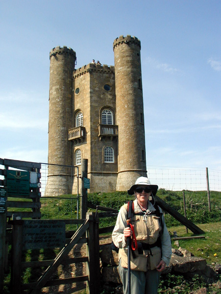
Nourished with a full cooked breakfast virtually identical with the prior ones, but delayed a bit because of conversation, we immediately started the climb up Broadway Hill to the Broadway Tower, a quirky but cool little stone tower (see the people at the top for scale) built about 200 years ago for fun. It has a mini- (micro-?) museum about itself and the Pre-Raphaelite painters who lived there, and from the top there are wonderful views out over the countryside.
Our way from the tower led through (yes!) gently-sloped and well-marked pastures, across more cultivated rock fields, and along a wide greensward called (on the map, at least), 'The Mile Drive', and hence into Chipping Campden. We got snacks at a bakery there, and Kelia sat on a park bench to rest and to write postcards, while I wandered up and down the high street and checked out the original shopping mall. The town was by far the busiest small place we have seen on the whole walk; I can't imagine what it must be like on a weekend in summer.
Before we walked on, Kelia and I looked in on the parish church building. Almost every one of these little villages (not to mention the larger towns) is its own parish, and each parish has its own building, almost all of them many hundred years old, surrounded by gravestones totally effaced by weather and lichen, with a small pipe organ, and plastered inside with plaques memorializing preachers, benefactors, or loved ones gone now 200 or 300 years. In the small villages the buildings are commensurately modest, but those in the larger places are considerably grander, reflecting the wealth as much as the piety of these communities. Chipping Campden's was definitely one of these, perhaps as large even as Cirencester.
I must admit to just a bit of letdown when we turned south - the rest of the walk, though scenic, certainly was now off the front (steep) edge of the escarpment, and the gentler slope on the back side, though easier to walk, just wasn't quite the same. It was about this time that I decided I should have planned the trip to start in this part, then go through the tough parts a few days in. None of that to say that I was unhappy with the plan as we were working it - we have had a great time and a good workout, and have seen some beautiful country.
Our way south this afternoon led through the village of Broad Campden and on along a quiet lane with virtually no traffic. We got to Blockley early in the evening - earlier than we had expected, whether because we were in better shape or just because the way was easier. We enjoyed the conversation with our hosts, who had lived for a while in eastern Africa, he working as an animal nutritionist. Gay is a photographer who augments her B&B income from sales of notecards made from her (very attractive) photos. Their house is piled with books everywhere - my kind of place! We had pub grub, of which we had begun to get tired, before turning in.
Day 9 - 24-Apr - Blockley to Upper Swell (15 km)
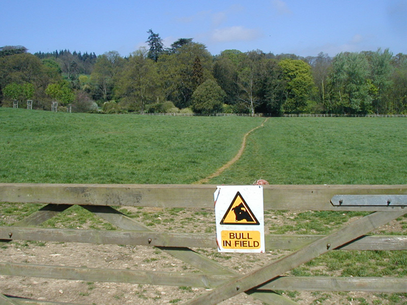
Nourished with a full cooked breakfast virtually identical with the prior ones, we set out for an easy walk on our penultimate day. We decided that we didn't really need to walk the couple of extra miles out of the way to see Moreton-in-Marsh, no matter how photogenic it might be, so we took the way straight south through the villages of Bourton-on-the-Hill and Longborough, passing many cottages with thatched roofs, and in particular passing through a field with a bull in it, fortunately without incident, unfortunately without a photo; we thought it imprudent to dally in the pasture.
There was nothing else notable that happened today - just a pleasant walk, and we cruised into Upper Swell just after noon. We dumped our bags and rested for about an hour before walking into Stow-on-the-Wold, where we got something to eat and window-shopped for a while, then walked back before dark and so early to bed.
Day 10 - 25-Apr - Upper Swell to Bourton-on-the-Water (12 km)
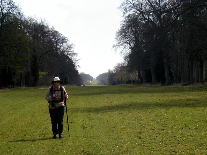
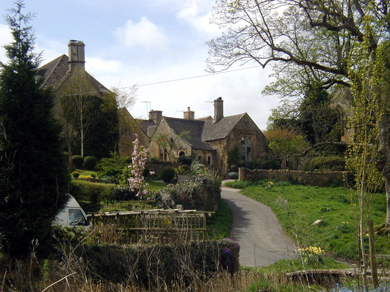
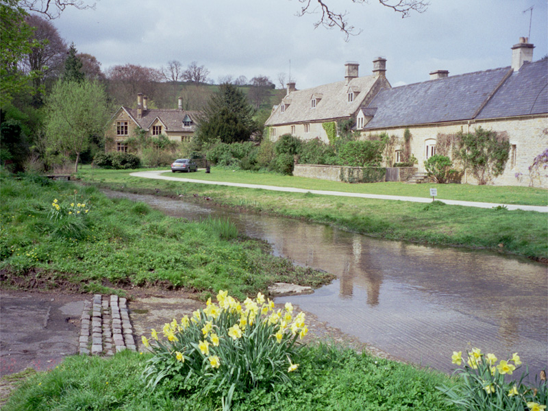
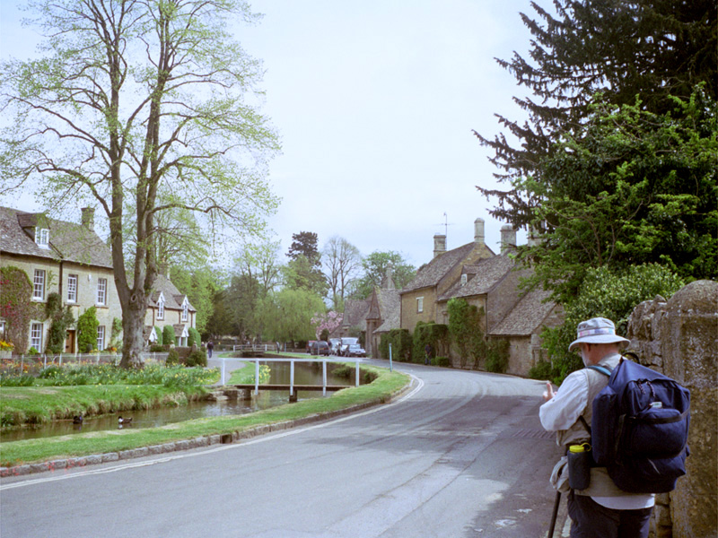
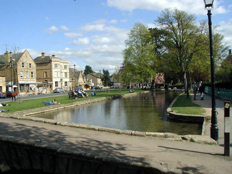
Because we had walked into Stow yesterday, we decided to walk directly to Bourton-on-the-Water, so, nourished with a full cooked breakfast virtually identical with the prior ones, we set off about 9am. We had a leisurely walk through Lower Swell (okay, it's us resting near Lower Swell), Upper Slaughter (pictures: one, two), and Lower Slaughter, all of which were very attractive, particularly Lower Slaughter, with its wide sidewalk along a little river with ducks and ducklings and its many flowerboxes. The walk from there to Bourton was very short, except that our room was all the way through and past the other side of the village. Even so, we got there just after noon, and following what had become our uniform practice, plopped down to rest for a while.
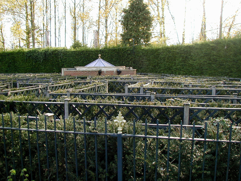
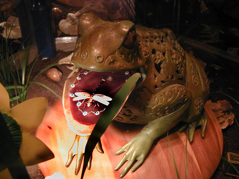
I had particularly scheduled Bourton for us because of an attraction I wanted to share with Kelia - the Dragonfly Maze, a for-real maze with a rebus puzzle to solve by traversing the maze and collecting clues, and with a view of a bejewelled dragonfly, once you knew the secret to getting the frog to open his mouth.
We spent the rest of the afternoon just walking around the village. It really is beautiful, with a river running through it, along the high street, with footbridges all up and down over it, and with wide walkways on both sides. Given all that, it was no wonder that the place was overrun with tourists, just like Stow had been. Both of them had multiple coachloads of day-trippers shopping up a storm, but all leaving at 6 when the shops close. We snacked in the afternoon - I had some spectacularly bad fish and chips - before walking back to our room.
I always feel a little strange when I get to the end of these walking trips - perhaps the emotional equivalent of stepping off the end of the people-movers at the airport, when you have to change pace abruptly.
26-Apr - Bourton-on-the-Water to Bath
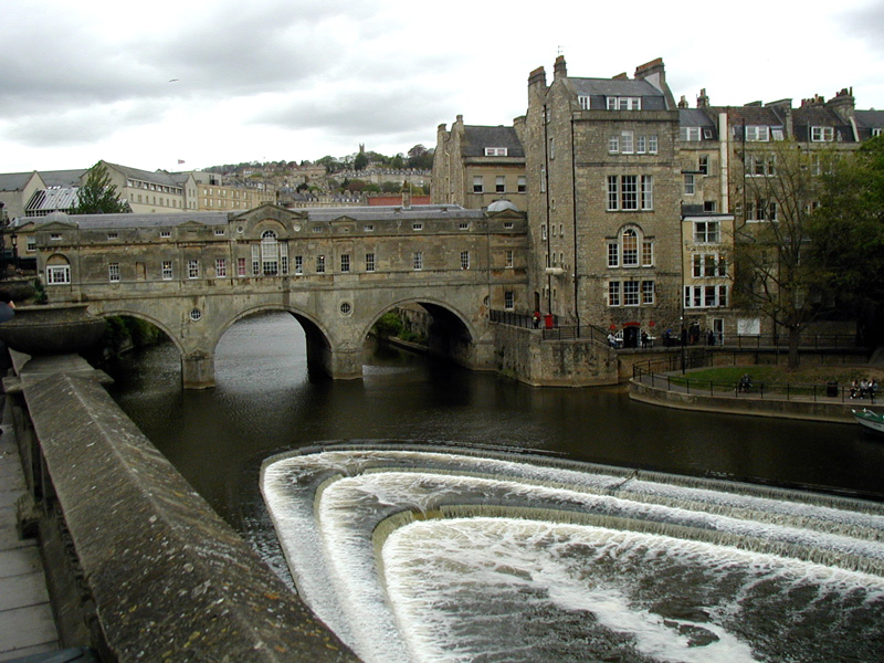
After a breakfast of cold cereal and toast (only!), we walked back into Bourton to sightsee for a short while before catching the bus to Kemble station, the train to Bristol, a taxi to the car rental place, and a rent car to Bath, where we located our B&B just a few minutes walk from the city center, then spent the evening walking around a quiet city and checking out the plaza near Pulteney Bridge, the weather blustery but not exactly wet.
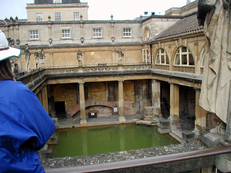
The next morning, we got to the Roman baths just after they opened - a good plan, since the city quickly filled up with tourists (okay, OTHER tourists), and most venues were pretty packed by 10 or 10:30. We spent the day taking in the other sights, the abbey, the Jane Austen museum (Kelia), and general window-shopping and people-watching. In the evening, we had a very tasty Indian dinner and went to a performance of the Bath Baroque ensemble, played on period instruments.
28-Apr - Cornwall
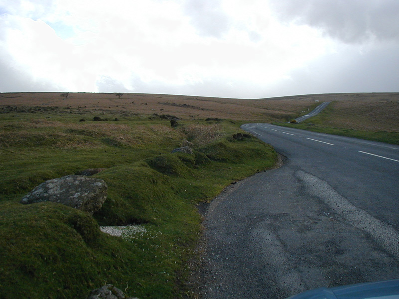
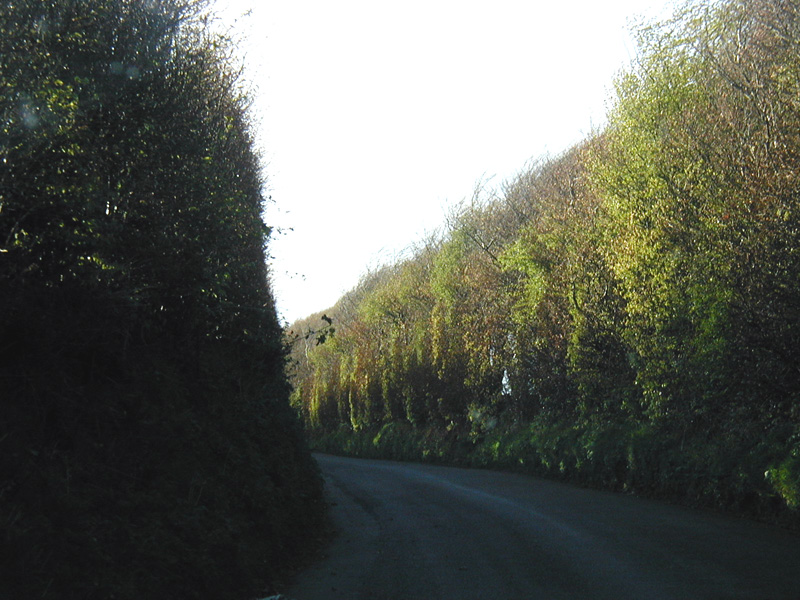
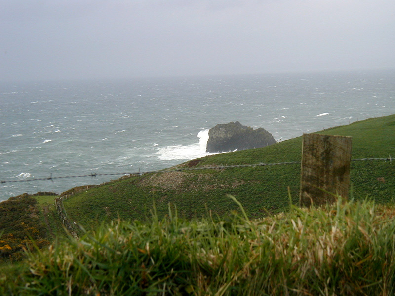
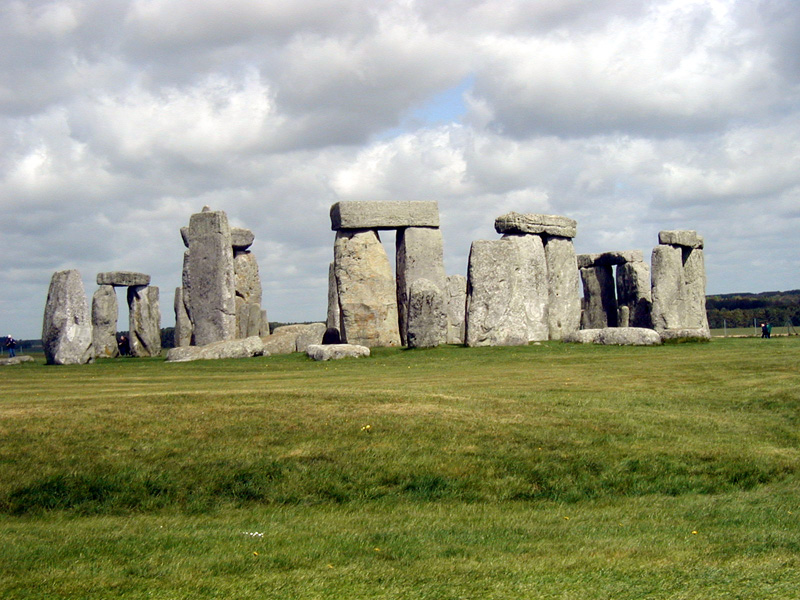
We had a free day before we had to get back to London, so we drove across Dartmoor, through Cornwall, and all the way to the Atlantic Ocean at Tintagel Head, the mythical home of King Arthur. We spent the night near Taunton, then drove the next day by way of Stonehenge back to Tunbridge Wells to spend the night with the Daniells, then quickly drive back to Gatwick, thence home without incident.
Read enough? If not, try http://www.ballou.us/BeLux2000 (another journal, of a walking trip through Belgium and Luxembourg in 2000).
Our hosts
We were generally quite happy with our hosts, and would recommend any of them for other travellers, whether on foot or by car. Here they are ([HR] are particularly highly recommended):
| Cirencester | The Bungalow - Carole
Richens 93 Victoria Rd - 01285 654179 |
| Minchinhampton | Hyde Crest - Anthea Rhoton [HR] 01453 731631 |
| Wotton-under-Edge | Wotton Guest House - Sandra
Nixon 31a Long Street - 01453 843158 |
| Uley | Hodgecombe Farm - Mrs
Catherine Bevan [HR] 01453 860365 - call ahead for dinner |
| Painswick (Edge) | Upper Doreys Rd - Sylvia
Marden Edge 01452 812459 |
| Cheltenham | Leeswood - David Boardman 14 Montpellier Drive - 01242 524813 |
| Winchcombe (Greet) |
Manor Farm - Dick &
Janet Day [HR] Greet - 01242 602423 |
| Broadway | Learmonth House - Jane and
Lee Hartman [HR] 102 High St - 01386 858996 |
| Blockley | Tudor House - Gay and Peter
Thompson [HR] High St - 01386 700356 |
| Stow-on-the-Wold (Upper Swell) |
Woodlands Guest House Upper Swell 01451 832346 |
| Bourton-on-Water | Elvington B&B - Ian
& Ann Tuckwell 01451 822026 |
| Bath | Victoria House - Anette
Smidt 40 Crescent Gds, Upper Bristol Rd - 01225 312812 |