On the kindness of strangers - my walk in the Ozarks, April 2009

This trip journal turns out to be as much a record of the kindness of strangers as a description of a walking trip, and I couldn't be happier that it is!

When I saw the National Geographic article on the Ozark Highlands Trail last fall, I was sold on doing it on the spot, and when I couldn't find anyone else who seemed to have any interest in walking it with me, the idea of making it a long solo walk took shape. Having almost 900 miles of trekking experience, I felt pretty comfortable in general with the notion of walking in Arkansas, where neither terrain nor climate nor remoteness is as extreme as in California or Colorado.

The challenges presented by the walk were typical except for one - getting there and back. Neither end of this walk is at a town, nor even on a public transport route - not even a bus. Kelia took the Gordian knot approach to solving the difficulty for me - she volunteered to drive up and back twice. Now that is true love! Of the other concerns, she helped me there, too, by sewing up a tarptent from silnylon to my specifications. Water was not an issue in the wet season, and in the event the abundance of water turned out to be the problem, rather than its scarcity! Since this was intended to be a through-hike with no possibility of resupply, I planned my meals to be light enough to carry 13 days' worth, at the expense of flavor and interest. Boring, but the trip is not about the food, is it? At least, not if you have to carry it on your back!

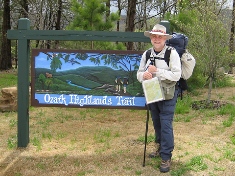
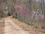
At the start of the trail

Link to NatGeo article
(Click on the bear to link to the National Geographic article that piqued my interest in this walk).

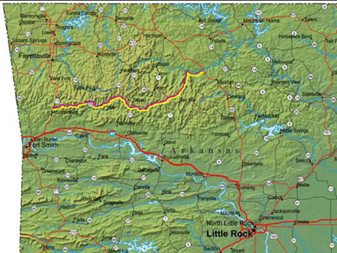
The trail runs right through the Ozark Mountains, starting at Lake Fort Smith State Park, just a few miles from Fort Smith, and ends on the Buffalo River, some 165 miles east. Since the trail ends nowhere near a paved road, I planned to walk an additional fifteen miles past that to the Tyler Bend Recreational Area just off highway US65.

Pondering the fact that fatality was one of the possible outcomes of this walk - not to be morbid - caused me to have a heightened awareness of the fact that fatality is a possible outcome of any day anywhere, which in turn heightened my attention to Kelia and indeed my appreciation for each day that God gives us. I'm hoping that that reminder will stick long after the trek is over.

Monday 13 April

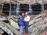
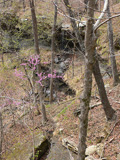
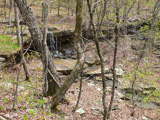
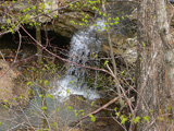
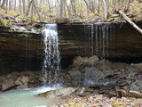
Lunch and waterfall at mile 0.8 The trip up was good - it has been a while since we have taken a road trip together. We overnighted in McAlester, OK, and arrived at Lake Fort Smith State Park around noon. We had stopped in Fort Smith to buy picnic lunches, so Kelia walked the first half-mile or so along the trail to see a pretty little waterfall and eat lunch with me before setting off for home.
Frog Bayou
Brambles 12, Legs 0
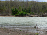
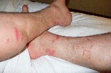
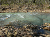
My first challenge came only 2 miles farther down the trail, probably about the time Kelia was exiting the park. The trail crosses Frog Bayou, one of the main feeds into the dammed-up lake in the park. It was running full from the recent rains, and was substantially wider and deeper than I had understood (if you look carefully in the photo, you can see the trail marker across the stream matching the one in the foreground). A couple of days later, as I was rereading the guide book, I came across a paragraph I had earler missed that warned that it was often impassable. I wish I had read that before setting out! I wasn't quite sure what to do, so I took off my pack, took off my boots and socks, unzipped my pants legs, and put on my water shoes. Then I spent about an hour ranging up and down the banks looking for a better place to cross, without success, and almost despairing of getting this walk off the ground. In the process I sliced my legs up pretty badly on all the brambles growing everywhere (this image was taken a week later).

After much prayer and deliberation, I picked a place where I could see rocks sticking up most of the way across, picked up a tree branch to use as an extra support, and started across, saying a prayer with each cautious step. Literally. Most of my stuff was in dry bags except my boots, which I tied together and hung around my neck, and I wasn't so much worried about getting things wet as about losing them downstream.

In the middle, the water was thigh-high, but not rushing as hard as I had feared - I had only a little trouble moving feet and poles - and I had almost made it across when my foot slipped and I sat down and stood back up quickly. The only things that got wet were the clothes I was wearing (all nylon) and one of my boots. Keine Sorge - I just walked the rest of the day in my river shoes, and everything dried out as I walked.

The only problem with all that was that it took me almost 2 hours to accomplish the crossing, so that by the time I was ready to stop that evening, I had made only 7-1/2 miles on the trail in 6 hours. The trail promised a bunch of similar crossings, which brought under question my expected pace for the walk.

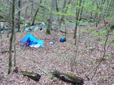
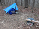
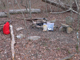
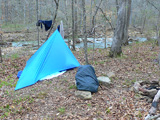
Campsite on 13 April The first couple of nights - before you're so blasted that it doesn't matter if your bed is level or comfortable - are usually pretty miserable, and so it was with me. I was camped by a stream, and was completely comfortable with the surroundings and being by myself in the outdoors, but still slept poorly because of all the rocks and the very fact that it was the first night out. The good news was that it was chilly at night - just perfect for me to zip myself up in my sleeping bag and rest at a comfortable temperature. (The red bag had my food - there are a few bear sightings each year, so some care was in order. My food was all in OPSAKs, so I thought that just putting it away from where I was sleeping was adequate precaution. In fact, I saw no evidence of bears around me ever.)

Tuesday 14 April

I'm really liking this little Brasslite alcohol stove I brought - it heats much faster than I expected, and the fact that it is totally quiet is cool. At less than 2oz, it is clearly the lightest stove I own. It burns denatured alcohol, readily available in any home improvement store. The alcohol is a lot friendlier to the environment than petroleum-based fuels; if you spill it, it just evaporates without leaving any residue. It burns with a very clear flame - in full light, you can't even tell if it is burning at all. It also burns completely without sound, perfect for a wilderness setting. Downside: however much fuel you pour into it, you have to let burn out. No valves. No muss. No fuss. No control.

I carry it in an aluminum WalMart grease can with lid, which doubles as my pot. It holds a pot handle, the stove, a windscreen, and a lighter. Very compact and very light.

What I need yet is a way to measure out the 1/4oz or 1/2oz of fuel needed per heating. Pouring out of a 32oz Sigg bottle and trying to guess the quantity is difficult.

I can tell after just one day that I'm going to be really tired of grits in about 2 weeks.

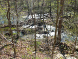
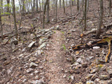
Typical soggy section of trail
Hurricane Creek
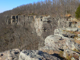
Cliffs on White Rock Mountain
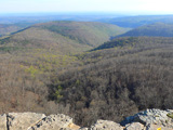
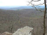
View from White Rock Mountain
The morning addressed my hubris. I had expected to make about 2 miles each hour, which seemed a conservative enough pace, but all the ups and downs and detours around downed trees and the whacking through brush and over little streams limited my speed to about half that. Clearly, this was going to make it very difficult to maintain my 13-1/2 mile daily pace.

And I'm afraid hubris is exactly the issue. The guide book suggested a pace of 1 mile per hour. I picked up instead on the comment that a reasonably fit person could walk the entire trail in two weeks, which was what I had budgeted. When Stan and I walked in Spain, we did 20 miles each day, but mostly on roads and good durable trails. For me to expect the same rate here was clearly a reach not completely informed by a sense of reality regarding the trail condition or my fitness level, even granting the months of practice walking I did to prepare for this walk.

As if that weren't enough, around noon I hit Hurricane Creek. It was becoming clear that last week's rains had swollen all the creeks. This one wasn't near as wide as Frog Bayou, but it was running fast enough that I wasn't going to be foolish enough to just try to walk across. I spent a half-hour ranging up and down looking for an easy crossing, again without success. Eventually I had the idea of testing it out frst without gear. I stripped to shorts and river shoes and waded out, discovering that it was in fact only calf-deep, so I collected my gear and crossed without incident.

A mile or two farther along, I lost the trail - one of the very few times where the trail markings were not more than sufficient to stay on the way. I ended up on a forest road that ran parallel, and continued on, expecting to rejoin the trail when it next crossed the road. It didn't take long to discover that I could make better time with a lot less wear and tear on my knees by walking on the road, even if the way was a bit longer, so I continued all the way to the top of White Rock Mountain at mile 19, where I caught some awesome views.

I cooked my dinner at a picnic area there, then visited for a while with a woman from California who had started a day before me, but had bypassed Frog Bayou completely. After dinner, I walked on another mile or two, hoping to find a good camping spot. Apparently, however, there are very few pieces of ground in the Ozarks that are flat and level. I spent the night slipping and sliding down my ground cloth, passing a miserable night, with consequences that manifested themselves the next day.

Wednesday 15 April

Water, water, everywhere
Typical forest road
Actually, I got started just fine, getting underway by 8am, and seeing some pretty scenery, but I hit the show stopper just 1-1/2 miles down the road, at Salt Fork Creek. It was flowing pretty fast, so I repeated the drill from yesterday - survey for an easier ford, then go in with bathing suit to test the way. This time, though, the rocks were really slippery; I didn't feel stable even without a backpack on. The only choice left was to backtrack a half-mile, then take a 2 mile detour to a forest road bridge. By the the time I got to the bridge, it was about 11am. Net miles covered: -1. I decided to walk the roads again, given the gentler inclines and smoother surface. Just a couple of miles along, though, I found that I was dragging at almost every step. It was really hot, and I was sweating profusely. I must have been dehydrated - I hadn't been paying attention to how much water I had been drinking, and that, coupled with the poor rest of the night before, would explain why I had no energy. Even when I started drinking more regularly, I was wasted. I stopped to rest for a while about 11:30, but even that didn't help, and I had to sit down again just an hour later. I was getting a bit depressed, and intensified my praying for some sort of resolution or guidance.

The problem with Providence, of course, is that you can never quite be sure about it. Joseph was stridently confident in his assertion to his brothers that although they had meant him harm, God designed to use their selling him off as a way to preserve his family. Mordecai was much less firm when he said to Esther, "Who knows whether you were not brought to the palace at this time just to save your people?" He did voice the deeper conviction, though, that I think is operative: "Whether you act or not, God will save his people." And that is the bottom line as far as I can reason out: whether God operates in a way that is perceptible to me or not, He is in control, and His goodwill towards mankind will cause events to work out for their good. All that being said, when He acts to my convenience, I am truly grateful!
Troxel, by Kneath
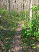
An atypically green section of trail
Now appears on the scene the first of the three angels of this story. I thought to put 'angels' in quotation marks, then decided against it - each of them was, witting or not, truly an angel - a messenger servant - sent to my benefit.

I had been sitting on the side of the road, praying, for about 2 minutes when a pickup truck with camper came around the corner and stopped. The driver, Kneath, asked if I needed help. I explained my predicament, and he offered to take me down the road a piece, since he was headed in the same direction. Kneath is a hunter and a photographer, and was in the hills to take a turkey or a picture, whichever presented itself first. We had a pleasant visit driving down a forest road at about 20mph tops - this one was a bit rougher than some of the others. Along the way he commented, "Perhaps you are the reason I came on this road today - I had planned to go another way...." I allowed as how I was a firm believer in Providence, and told him that I believed him to be the agent.

Kneath was very kind. He offered me water. He offered me tea. He offered to take my picture. About the only thing he didn't offer was to finish the walk for me, and I can hardly blame him for that! I regret that I was too wasted to think to get his picture - I would be proud to show it here.

He dropped me off at mile 37 - seven miles past where I had hoped to spend the night - at 2pm, so, refreshed after the ride, I walked several more miles down a nice green trail before finding a campsite that had a level place to sleep, not to mention a throne to sit on while I cooked my dinner.

Campsite 15 April Campsite 15 April

Thursday 16 April

View from Hare Mountain, where I called Kelia
Along the razorback
Trail through a burnt area
The campsite was in fact relatively level, and I slept quite well. In the morning I walked 5 easy miles in fairly short order. When I got to the top of Hare Mountain, the highest point on the walk, I attempted a call to Kelia on the mobile phone - Kneath had assured me that in spite of the lack of coverage indicated by the service providers that calls were possible from high points. I was in fact able to talk to her for a few minutes, which was a great comfort to my soul (and apparently even more so to hers).

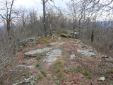
I walked on what the guide book called a razorback - a narrow ridge with dropoffs on either side. That was pretty cool. The last part of the morning's walk was through a section that had been burned - not really very attractive.

When I got to mile 47, I hit a show stopper for real. The next nine miles of the trail were closed for controlled burns. "Sorry for any inconvenience." That means something different to a person on foot than it does to a person in a car! In my research for the walk, I found no mention of these burns, and when I saw signs at the state park, none of the maps and schedules indicated this section of the trail. Information is still not well-flowing in rural areas, clearly.

This time there was no parallel road. The only thing for it was to walk a little way into the burn zone, ford yet another creek, then take a forest road out of the hills south to the main road to try to catch a ride around the burn zone, or, worse, walk another 12 or 13 miles on the road.

And now the second angel appears.
I didn't know how long I would have to wait - the road wasn't that heavily trafficked, clearly - but within five minutes a truck came down the road. I waved him down, explained about the burn zone, and asked for a ride down the road a ways. He then indicated that he was also trailbound, but didn't exactly know how to get to the trailhead, so had me get in. In the event, where he was wanting to get to was the trailhead just at the far end of the burn zone. Providence, wouldn't you say?
Charles, angel #2 Charles is a tax accountant taking a break (that today was April 16 was no accident of timing on his part!). He is also the Scoutmaster of an LDS troop in Tulsa, so we had good connections there as well. We walked together about four miles down the trail (fortunately he was headed in the same direction I was!) and camped together at a very nice campsite just at mile 60. At supper, he looked askance at my couscous and vegetables (I looked askance at them, too, for that matter) and asked me if I wanted a spare lasagna dinner his wife had had him pack as backup. Did I! What a treat! What kindness on his part!

Friday 17 April

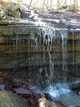
Waterfall We got up about daybreak, and I parted company with Charles - he was walking back to his truck, then driving back to walk to Hare Mountain for the day. I made very good time this morning - some six miles in three hours - almost all on level ground. After an hour rest, I covered some of the neatest scenery so far - about a half-dozen waterfalls between miles 66 and 68. I was determined to make 13 miles today, so I pressed on to Lewis Prong Creek, which was flowing wide and fast, but not deep. I made camp beside it, and even took a blitz-sitz-bath (the water was icy) and rinsed out my clothes.
I did find it gratifying that when the trail was not an obstacle course that I could walk about as fast as I had planned. It was certainly the case, though, that all the stop-and-start business kept me from ever getting into a good rhythm.
Typical trail Waterfall Waterfall Waterfall Campsite 17 April

Saturday 18 April

Yet another creek crossing
Nuisance stream
I might have had a bunch
more photos this day, but
I really was focused on
keeping safe, and just
wasn't prepared to stop
any more often than I was
already being forced to do.

In fact, I don't have many
more photos than these.
I have not yet figured out
how to experience the
event and document it
at the same time. I can do
only one or the other.
It was raining a bit - drizzling, really - when I went to sleep, and I expected the clothes I had hung out to dry would be soaked, but it was apparently dry all night, since my clothes were dry in the morning. However, it started drizzling again about the time I packed up, and continued all day long. It was completely overcast, and cool enough, but the rain was heavy enough that I needed to wear my rain suit, and the humidity was high enough that I was sweating like crazy. I walked five miles before noon, through some fairly rugged and quite pretty scenery (which would have been much more attractive absent the rain!). I walked through the aptly-named Waterfall Hollow, which contained three or four within a quarter-mile stretch.

The hollow also had four or five more creek crossings, a couple of which were starting to get dicey - one of them I had to slip and slide down a ten-foot bluff to get to the water, which I had to do some distance upstream of the trail crossing, then creep downstream in the creek bed to get to where I could get up on the other side. In addition, the rain was continuing, and the combination of rain, runoff, wet leaves, algae-covered rocks, and brittle slate on narrow trails on steep hillsides made the walking more and more treacherous - there were long stretches where essentially every step had to be planned to avoid slipping down the hillside. All of this was compounded by the poor condition of the trail itself after the bad icestorms in January, which left lots of downed trees, some of them quite large, lying right across the trail, and worse, leaving a big hole from the root ball of a tree that had been blown over. A disproportionate number of the holes were on parts of the trail that were on inclines. What a bother! And, as I realized more and more through the course of the morning, not just a bother, but increasingly dangerous. I slipped and fell several times, bruising my shins, and it was clear by lunchtime that it was just getting worse. Kneath had mentioned that a mobile-phone-like device was available that broadcast position that could be tracked on Google Earth, as well as sending an emergency alert, and I can see how having one would be a good idea if you're traveling by yourself. In this case, however, avoiding the risk completely seemed to be the course of greater wisdom, and I started thinking about changing my plan.

My prudence won out over my pride when I reached a forest road, and I decided to come off the trail 100 miles short of my planned endpoint. I stood for a couple of minutes in the rain on the gravel road, then started walking, hoping I was on the right road to find the Burger Barn, a hamburger stand mentioned in the guide book as being some eight or nine miles south, which I hoped would be the first step back home.

Now appears the third angel.
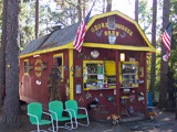
Burger Barn
Angel #3, Zelma Marie, with Snowball
After I had walked for no more than ten or fifteen minutes, a truck approached me oncoming, headed north. I waved it down, and the driver stopped and cracked her window. I asked about my prospects down the road, and she replied, "There's nothing down that road for a long way. If you're looking for the Burger Barn, it's on my way, but it's a real long way." She allowed me to toss my backpack onto the stuff in the bed of her truck, and started north (and eventually east, and eventually south, as it turns out - forest roads up there are all loopy). We drove for well over ten miles - much farther than I could have walked before dark - on the way to the Burger Barn, during which drive I learned from her that the nearest services wouldn't be until Clarksville, yet another 20 miles to the south, which was where she was headed. Sure enough, when we passed the Barn, it was just a little building about the size of a taco stand, with no inside seating, and certainly no suitable place for me to have overnighted. (This image is from someone else who was by there on a drier day.)

My third angel's name is Zelma Marie, and she has lived almost her whole life in the area. She was happy to help me out, and I was most certainly happy for her to do so! I'm not sure she ever believed me, but I told her more than once that she was an answer to my prayer. While we drove and talked, it was pouring down serious rain, enough to make the truck threaten to hydroplane, and enough to make her little dog Snowball quiver and shake, and enough to almost make me cry to realize how very miserable I would have been had I still been on the trail. What a sense of relief to instead be travelling toward home in a warm, dry, comfortable cab!

Zelma and Snowball dropped me off at the Comfort Inn in Clarksville, and I returned to civilized life instantly. What a great ending! I checked in, carried my backpack straight to the bathroom and into the tub to drain, then hobbled across the street for a Wendy's happy (for me) meal before calling Kelia to arrange the trip home.

So, was I disappointed? Well, yes. I take pride in these walks, and I hate to say that I didn't finish what I started (or worse, couldn't finish what I started). On the other hand, as I get older, I do think I'm beginning to get a shade wiser, and that includes knowing when to stop and having the will to stop.

The real joy of this trip, other than spending a week of nights in God's great outdoors, was experiencing the kindness of strangers, each one of whom said, more or less directly, "Normally, I don't pick up strangers, but in your case...." That is a vivid reminder to me to be compassionate to people around me, and that lesson alone makes the frustrations of this walk worth while. Thank you, Kneath and Charles and Zelma, for your kindness to me!


And the real kicker? Once I was back in Houston, we had a plumbing leak one day and a separate plumbing leak the next. If I had been on the original plan, I would have been on the trail and Kelia would have been in Dallas when they sprung. By the time we would have returned home, our ceiling would be on the floor and there would have been water everywhere. I do believe in Providence!